Part 2: The Dusky Track
…walking the Dusky Track after a solo traverse of the Kaherekoau Mountains (Dec 2020-Jan 2021).
8. Shaky recovery
Lying alone and having just woken up in Hauroko Burn Hut the 67 km deep 4.8 magnitude earthquake about 40 km south-west of me hits me like a brick.
Has the alpine fault ruptured?
The slow rocking lasts long enough for me to consider whether perhaps this is the alpine fault going, question whether I can unzip my tent, escape my sleeping bag and liner and stop, drop and hold in a timely manner if the hut starts to deteriorate in structural integrity, how long I still have food for, and what is the fastest way back to civilisation.
Luckily none of these require action as the movement stops and I lie there for a few minutes just processing. This is perhaps the first properly noticeable earthquake I have experienced. I extract myself from my complex set up of strung up tent inner, sleeping bag and liner and brace myself for the sandflies. They seem to be having a slow start this morning and I am able to eat breakfast outside of my tent inner provided that my socks have not slid down exposing my ankles. The sandfly graveyard on the kitchen bench has reestablished itself with a vengeance during the night and as I am sweeping the hut in preparation to leave I once again accumulate a pile of black corpses for the dustpan.
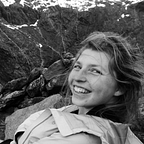
It is a slow morning. I read the cheesy novel that I swapped Nineteen Eighty-Four for, dip into my spicy broadbean snacks and assess my injuries from the last two days. I have done something to my right index finger and can barely grip anything. My hips are a little sore from when I involuntarily performed the splits on my descent into the Hauroko Burn. My chin is still very bruised and a little cut up from the descent into the Russet Burn. I think I have done a sufficient job of cleaning the blood off my nose although there might be a cut and I am not sure if the blood came from said cut or from a blood nose caused by the impact. My shoulders and biceps are very sore from the constant lowering and lifting along, up and down bluffs to get in and out of the Russet Burn. My lower lip is in a right state. It is very swollen and eating and drinking are slow and painful activities. I wonder at which point one requires stitches, but I don’t have a way to assess the damage and it would not be an option for another week at least so I decide it will just have to be.

I retrace my steps from the day prior then continue up the track. It is uneventful. Breaks remain at an unsatisfactory length due to the prompt onslaught of sandflies, and I only stop long enough to take a sip of water and get out a small snack for on the go. Even walking is often not enough to escape, and my slow progress along the three-wire bridge makes for a highly challenging activity as both hands are occupied not just with holding the wires but ensuring my walking pole does not plummet into the river below.
At the top of the short climb the Dusky finally starts to look like it wants to put out something with a bit more personality than your average weekend hike, but this soon lapses back into flat river side travel until I reach the empty Halfway Hut. The hut is lovely and I watch tītitipounamu (Acanthisitta chloris) flitting about in the shrubs from inside the hut. In contrast, the toilet is far from lovely.
“Maybe my face will be healed by the time I see people!”
9. Tamatea
It is not yet raining when I depart Halfway Hut in the morning, but it sure sets in as I reach the first walkwire. I put my raincoat on and pack away my camera in its ultra safe triple bag set up. The climb to Furkert Pass begins and leads me along a steep stream, traversing rock slabs with pockets of mud and subalpine plants inhabiting the forest edge. Sundews (Drosera stenopetala) ranging from deep red in the sun to pale green in the shade and everything in between cover the wetter areas, which is basically everywhere. As I emerge above the bushline the rain clears somewhat and I am left with gentle drizzle and exceptionally moody clouds. It is exactly how I imagined the Dusky Track would be.


Lake Roe Hut is my favourite hut on the Dusky so far [and remained my favourite]. It is in such a spectacular location that I almost topple off the boardwalk into the swamp on my way to the toilet (multiple times) as I am too busy admiring the views. I settle in, eat lunch and contemplate whether to go up to Lake Roe today, the last day of 2020, or tomorrow, the first day of 2021. The weather clears somewhat and I decide to head up to the lake. I unfold and pack my incredibly useful ultralight daybag then head out. My intention is to go to the lake. Yet somehow I find myself on the summit of Tamatea Peak (1640 m).
The side trip to Tamatea Peak is very straight forward. I follow the cairned route up the broad ridge from Lake Roe and then sidle across to avoid pt 1595. From here it gets a little more scrambly with amazing views into the rocky basin interspersed with numerous deep lakes on the other side of the ridge from Lake Roe. Dense clouds roll over the range and I am not granted views of Tamatea/Dusky Sound from the summit, but it is beautiful all the same. I rush back, worried the cloud will hang about and I will get caught in the bluffs on my way down. There is an evening chill to the air as I make it back to the hut and tītitipounamu (Acanthisitta chloris) flit about in the trees outside.
Tamatea-ariki-nui was the captain of the waka Takitumu (Takitimu) when it left Hawaiki for New Zealand around A.D. 1350. Tamatea eventually settled in Tauranga, and Tahu took charge of the waka, travelling south in search of pounamu. Also on the Takitumu was Tamatea-pokai-whenua, a legendary traveller and descendent of Maui. Tamatea-pokai-whenua left the Takitumu in Turanga (Gisborne) and travelled by foot and canoe through the North Island, leaving his name on many landmarks, the most famous being Taumatawhakatangihangakoauauotamateapokaiwhenuakitanatahu, or “the hill where Tamatea-pokai-whenua played his flute”.
Check out ‘Tamatea Dusky’, which is a stunning book covering 250 years of the areas history.

New Years eve is an excellent excuse to delve into the supply of chocolate sent to me by my Dad for Christmas. And to lighten my pack. I finally notice that I am alone. Of all the places to spend New Years eve on the Dusky I would have picked Lake Roe Hut, but it seems the groups ahead of me have not taken the same approach. It is incredibly quiet except for the squawking and screeching of kea (Nestor notabilis), and I am asleep in time for the new year.
10. Solo Seaforth
Today it is 2021. Today is the day I find out if I can get out via the Dusky Track. Today I need to cross the Seaforth River where the walkwire has washed out.
There has been quite a bit of rain overnight so I don’t take my time getting ready in the morning. My probably very inaccurate week old forecast suggests that there is more rain coming and my chances of crossing the Seaforth in flood are less than zero. The weather puts on a show for me as I head across the Pleasant Range; puffs of mist cling to the mountains and rise out of hollows and the sun shines.
Tamatea/Dusky Sound is a mist filled hollow extending inland from the ocean and as I walk it gradually clears. By the time I reach bushline the sound has cleared but the sky has become obscured. It feels like it will rain. I hurridly consume a muesli bar then plunge myself into the descent from the Pleasant Range into the Seaforth valley, hoping to beat any significant rainfall.

The descent is indeed steep, as suggested by the contours on my map and the hut book comments regarding chains. Said chains are incredibly shiny and look rather out of place. I don’t use them because I don’t need to, although it is among some of the steepest track I have come across. I descend into taller beech forest interspersed with flowering rātā (Metrosideros umbellata) lighting up the forest floor with their bright red bristly flowers as the ever darkening sky plunges the forest into a sort of twilight. As I reach the flat the rain reaches me.
I arrive at the Seaforth and assess my situation. It is not good [It was up when I reached it, although I did not realise]. The recommended crossing is a no go for me, involving a stomach depth sludgey bottomed channel to even get to the main river. I head downstream and get about halfway across before turning back. Upstream the river has broad swamps along its edges and I am forced back to where the walkwire was after a short explore. I stare at the recommended crossing trying to convince myself it will work for me since it works for most others, then reinvestigate where I initially tried to cross. I finally spot an option that might work, just downstream of where the three-wire was located. I use the calm sections just upstream of stranded logs where there is less flow and a build up of sediment and make it across in relative comfort. It is definitely right up there in terms of what I could cross solo. My feeling of relief upon reaching the true right of the Seaforth is immense. With no massive river left to cross I will definitely make it out via the Dusky.
I have a pleasant afternoon at Loch Maree Hut, listening to the rain pounding against the roof and watching the Loch level rise. Apparently, if you can only see 30 stumps in Loch Maree your best bet is to stay put. I see a photo and head outside with my film camera to figure out how to take in in the pouring rain. Conveniently, there is an umbrella propped against the hut which provides a perfect portable shelter. It was meant to be. A friendly kakaruwai (Petroica australis) oversees my use of the water tank. It is getting dusky as two couples arrive back from Supper Cove. I haven’t seen a single person in over eight days. One couple know my flatmate, and the other couple ran an orienteering camp I attended a few years ago. It is a small world.

11. Supper Cove
I consider not going to Supper Cove. But I wouldn’t really have done the Dusky if I didn’t go. So I pack enough for a night in case I get stuck and head out into the pouring rain. I am cold and saturated within minutes. It is a miserable trudge to Supper Cove. Heeding the warning of both couples and multiple hut book entries I keep an eye out for the low tide turnoff, and I am still looking for it when I reach Supper Cove Hut.

Supper Cove is nice. I eat my lunch and head back to Loch Maree. Sunshine peeks through but doesn’t manage to banish the rain entirely and with the tide coming in the river crossing where the tree has occupied the three wire bridge has become considerably deeper. With the entirety of my shorts now saturated some quite significant chafing develops on my thighs. But that has nothing on what happens to the back of my left calf. The saturated canvas of my left gaiter loses its rigidity and completely disintegrates the skin on the back of my calf. What can one do.
12. Saturation (cont.)

There is no escape from the pain I experience every time anything touches my chafed thighs or calf, be it my shorts, a plant or myself. On top of the pain associated with every step the weather is still rather miserable and the track along the river flats hasn’t been cut for a while so I am constantly brushing through water laden vegetation that actually makes me more wet than the occasional rain showers. My non-waterproof already-saturated raincoat doesn’t help.
The river flats go on forever but finally I catch a glimpse of Rebecca Falls through the mist and begin the climb up to Gair Loch. The climb is through low dense forest covering a massive boulderfield, and it is enjoyable hopping over the big moss covered boulders, gradually gaining elevation. Once alongside Gair Loch however, the route marking becomes a little more difficult to follow, between the copious criss crossing animal trails and the many tree falls.
When I reach the head of Gair Loch I look ahead and locate an orange triangle on a single tree sized island in the middle of a rather large pond like water body. I probe the depth and realise that it is indeed a pond. I probe along the edges with my pole and find a submerged log, carefully, I traverse a number of submerged bridges through the pond until, right at the end, they run out and I am forced to just wade through the remaining thigh depth sludge to make it to the end of the pond. From there it is a short five minute walk to Kintail Hut.
I am cold and wet and the fire flatly refuses to produce any heat or continuous flame. To help matters it is still raining and there is no dry firewood to be found inside or outside the hut. I resign myself to the prospect of wet clothes for another day.
“I don’t have any undies that are dry as I rewashed a clean pair instead of washing a dirty pair…”
13. Road walking
It is moody and misty but it is not raining. I lose the track within about 30 minutes of heading off, but manage to follow some quite pleasant deer trails until I reach a massive old slip and spy some big orange triangles further down the hill. The track is regained and I begin the climb to Centre Pass. It is short and steep, with massive mossy mounds below the tall beech trees which provide many suitably comfortable places for me to rest. Then I am in the final alpine section of my trip.


Lobelia angulata | Pānakenake
A small mat forming plant with dark green rounded leaves and bilaterally symmetrical white flowers. It can be found across Aotearoa in damp places and the tiny leaves can be cooked and eaten (if you are particularly desperate I suppose). It makes an excellent groundcover, and in some parts of the country it invades bowling greens and is treated as a weed.
I reach Centre Pass and have lunch. It is a touch drizzly and incredibly windy, and today, I decide not to climb Mt Memphis. Instead I practically run down from Centre Pass, pausing only to fill up my drink bottles and rescue a pack liner that I spot suspended half way up a narrow cascading waterfall above the track. The track is wet but fast and quite different to the mossy quiet forest on the other side of the pass. I emerge into a spectacular clearing that is boulderfield covered by dense Olearia ilicifolia shrubs, with only one narrow trail running through the spiky field. To my right is a sheer cliff, the source of the boulderfield.
Then the track drops almost vertically into the Upper Spey, passing through beech heavily laden with native mistletoes in flower, shedding their bright red flowers onto the forest floor. The gradient changes by almost ninety degrees and soon I reach stretches of boardwalk announcing the presence of Upper Spey Hut. I eat a snack in safety then carry on, flying down valley along the flat, albeit swampy, track. Then I hit the road. It is such a contrast to anything I’ve seen over the last two weeks. And is probably the hardest terrain to walk along of the whole trip. My feet are properly sore when I reach West Arm Hut.
“Questions the Dusky has made me ask myself:
- What is it like to hike with a waterproof raincoat?
- Am I hiking or playing stuck in the mud?
Skills I’ve improved by walking the Dusky:
- Sandfly evasion.
- Marginal solo river crossings.
- Deep swamp avoidance.
- Log balancing.
- Chafing acquisition.
My social skills took a hit though.”

14. People
I wake up far too early and go back to sleep. Today there is no obligation to get up and move, in fact I need to figure out how to spend my time before catching the ferry to get to Manapouri. It is pouring with rain so I don’t particularly want to venture outside until I have to. I pack, journal, read and chat to Ursula, and eventually it is time to put on my smelly coat and socks, heave my still unreasonably heavy pack onto my back and start the walk down the road to West Arm.
There are about ten people inside the information centre, which is already a lot for me to take in. I plop my things outside and put on a dry jacket before escaping the really quite excessive sandflies outside. Only minutes later a bus pulls up. An additional 70 people crowd into the centre and it really is quite overwhelming. They are all clean and dressed in tidy clothes. The ferry takes forever and finally we get on. I notice how comfortable it is to sit in a heated room with panoramic views of the lake and misty mountains, and the padding on the seat and the backrest. To be covering so much ground, so quickly, with no effort whatsoever. It is quite glorious.
But it must come to an end. Manapouri is also being subjected to pouring rain so I pay and dash up to the cafe to order myself hot food that I don’t even have to prepare myself. Then I commit to the now rather inconvenient hitchhike back to Lake Hauroko. Luckily it is warm and walking along the road doesn’t involve brushing through water laden vegetation so I am not yet too miserable when I get picked up about five minutes in. The boys are doing a surf trip around the lower South Island and are able to take me to the Lake Hauroko turnoff. I will make it to my car tonight. I can walk 32 kilometers in the remaining 4 hours of daylight…
I am getting close to the gravel road which marks 20 km to go and 12 km done. I am walking past a guy in a paddock who is wantonly spraying gorse, when he pauses what he is doing and calls out to me, enquiring where I am headed. I reply, probably quite dryly, that I am headed to my car at Lake Hauroko. He points out that I am still 20 km away and I relay that I am far too aware of this, probably in the same dry tone of voice. He calls back and asks if I want a ride, to which I respond that I most certainly do if there’s one going. He says that if I give him five minutes, he’ll finish up and pop down. I cannot believe it. I jump into the truck and he puts one of the softest caramel coloured puppies I have ever encountered on my lap and tells me that Odin has just been taken from his mother and might get a bit whimpery. This is correct but he soon falls asleep on my lap and I am left stroking his exceptionally soft coat until we reach my car.
To see my route for the Dusky Track click here, and to read about the traverse of the Kaherekoau Mountains that got me to the start of the Dusky track click here, the route for the full two weeks can be found here.

*f denotes a photograph taken with the old Olympus OM30 film camera my mother gave me.
References:
‘TAMATEA-ARIKI-NUI (Tamatea the High Lord)’, from An Encyclopaedia of New Zealand, edited by A. H. McLintock, originally published in 1966.
Te Ara — the Encyclopedia of New Zealand.
‘TAMATEA-POKAI-WHENUA’, from An Encyclopaedia of New Zealand, edited by A. H. McLintock, originally published in 1966.
Te Ara — the Encyclopedia of New Zealand.